  |
Orange Earthquake Alert in
Tanzania |
Summary
|
On 7/17/2007 2:10:04 PM UTC an earthquake of magnitude 5.9
has struck the moderately populated region of Tanzania in
Tanzania.
| Humanitarian
Impact |
|
| Population vulnerability |
|
| Tsunami probability |
|
| Landslide probability |
|
| Nuclear radiation probability |
 |
Whether international humanitarian aid is needed must be
decided by an expert. However, the following automatically
calculated elements can help. This earthquake has potentially
a medium humanitarian impact and the affected region
has medium vulnerability to natural disasters. 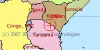
| Event Date Univ. Time: |
Tue, 7/17/2007 14:10
UTC |
| European Time of the event: |
Tue, 7/17/2007 16:10 CEST (Brussels,
Paris, Rome) |
| East America Time of the event:
|
Tue, 7/17/2007 09:10 EST (New York,
Washington) |
| West America Time of the event:
|
Tue, 7/17/2007 06:10 PST (San
Francisco, Los Angeles) |
| East Asia Time of the event: |
Tue, 7/17/2007 23:10 JTI
(Tokyo) |
| |
| This email report was
automatically created or updated by a computer on:
7/17/2007 3:02:55 PM UTC (52 minutes after the
event) |
| Word/Fax
version |
Explanation of alert calculation:
The impact model combines magnitude (M), population within
100km (P) and vulnerability ECHO average score (V) using the
formula:
alertscore = max(M-4.5,0) * log10(max(P /
80000,0))^ 0.5 * max(V,0.5) ^ 1.5 / 3
The weighted product
of magnitude, population and vulnerability (1.88) gives an
alertscore of 1.14720587538654
Then alert is Red if
alertscore>2, Orange if alertscore>1 and Green if
alertscore<=1. |
|
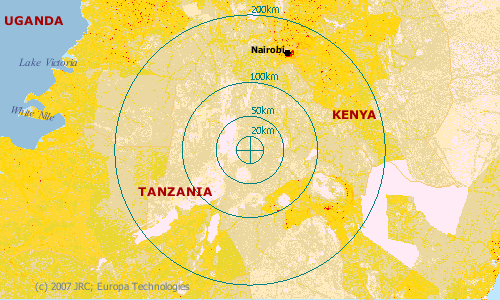
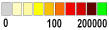 Population Density
near epicenter (people/km2). Image area: 6x4
decimal degrees (approx. 650x450km2). Population Density
near epicenter (people/km2). Image area: 6x4
decimal degrees (approx. 650x450km2).
|
|
Tsunami propagation for lat/lon =-2.57/36.31 and
magnitude=5.9
http://dma.jrc.it/output/saved/gdacs/eq/ts28765.jpg![]() | |
Earthquake Event

Characteristics
- Magnitude: 5.9 M
- Depth: 30 km
|
Location
- Location (Lat/Long): -2.57 | 36.31
- Country: Tanzania
- Province: Arusha (population: 1655668)
- Region: Tanzania
|
Time
 UTC/GMT (Greenwich time): 7/17/2007
2:10:04 PM UTC/GMT (Greenwich time): 7/17/2007
2:10:04 PM
- Local time: 7/17/2007 4:35:18 PM
|
Previous reports for this earthquake.
| ID |
Event Date/Time |
Lat/Lon |
Magnitude |
Depth (km) |
Source |
Publication Date/Time |
Delay |
.gif) 28761 28761 |
7/17/2007 2:10:45 PM UTC |
-2.9169, 35.581 |
6 |
22 |
NEIC |
7/17/2007 4:26:55 PM CET |
16min |
| 28764 |
7/17/2007 2:10:50 PM UTC |
-2.84, 35.2599 |
6.1 |
33 |
NEIC |
7/17/2007 4:56:52 PM CET |
46min |
| 28765 |
7/17/2007 2:10:04 PM UTC |
-2.57, 36.31 |
5.9 |
30 |
EMSC |
7/17/2007 5:02:55 PM CET |
52min | | |
About the data
Source: European-Mediterranean Seismological Centre
(EMSC)
Magnitude: definition
Depth: In general, shallow earthquakes are most
destructive. Earthquakes deeper than 300km rarely cause damage
and casualties. Default values of depth (33km) are given if it
could not be accurately determined.
Region: as specified
by the Source
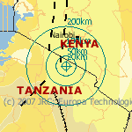
Tectonic map
 |
Earthquake Impact Details
Potentially affected People
|
Population Data |
| Radius
(km) |
Population |
Density
(people/km²) |
| 1 |
6 |
6 |
| 2 |
137 |
10 |
| 5 |
670 |
8 |
| 10 |
2490 |
7 |
| 20 |
9530 |
7 |
| 50 |
64590 |
8 |
| 100 |
649494 |
20 |
| 200 |
9477793 |
75 |
The population in the area of this earthquake if 8
people/km².
The earthquake occurred at 16h local time. At this time a
day, more people are at work and therefore more vulnerable to
collapsing office buildings. During traffic hours, people can
be affected by collapsing bridges and other road
infrastructure. |
About the data
Population data: derived from the LandScan 2002 dataset provided by Oak Ridge
National Laboratory, which
disaggregated census data into pixels of ~1km2 (or
30 arc seconds).
|

Damage
The affected region has low level of urban area (0%) and a
high level of cultivated area (31.8%). In urban areas more
damage can be expected than in cultivated or natural areas.
| Radius (km) |
urban areas |
cultivated areas |
other |
| 200 |
0.08% |
31.85% |
68.06% |
| 100 |
0% |
22.16% |
77.83% |
| 50 |
0% |
23.05% |
76.94% |
| 10 |
0% |
18.95% |
81.04% |
In general, earthquakes of magnitude 5 to 6 cause, at
most, slight damage to well-designed buildings, but can cause
major damage to poorly constructed buildings over small
regions.
For more information on the intensity of the earthquake
around the epicentre, please refer to the USGS ShakeMap
product (http://earthquake.usgs.gov/shakemap/global/shake/index.html) |
About the data
Land use data from GLC2000. This data is specific to
this earthquake.
This damage assessment is
based on the average damage of earthquakes over a 100 year
period as compiled by USGS. The information is not specific to
this earthquake. |
Resilience and Vulnerability
Resilience is the capacity of the population to cope with a
hazard. Since much of investments in earthquake preparedness
and available funds for quick response is related to household
income, the GDP per capita can be used as a rough indicator of
resilience.
Tanzania has a GDP per capita of 188 PPP$ (Parity
Purchasing Power Dollar, about 1 Euro) and is therefore part
of the low level income countries. Therefore, the earthquake
happened in an area of low resilience.
Based on the combination of 9 indicators, ECHO attributes
Tanzania a medium vulnerability. |
About the data
|
Exposure
Both conditions for survival and conditions for delivering
aid strongly depend on the current weather and temperature.
The following graphs show the current and forecast
weather.
Current weather conditions and forecasts at
earthquake location (lat: -2.57 - long: 36.31)
![Temperature chart currently not available. Try to refresh page.]()
![Precipitation chart currently not available. Try to refresh page.]()
![Cloud cover chart currently not available. Try to refresh page.]()
More detailed observations at closest weather station
(Arusha): WeatherByWeb
- NOAA
|
About the data
Source: www.calle.com/world. The data is not very reliable, but it gives an
indication for remote regions where more detailed information
is not available. The data is interpolated for the given
latitude and longitude from the closest airport weather
stations. |
Secondary effects
Probability of secondary effects:
- Landslides: The maximum slope in the
area of the earthquake is 48.971% and the maximum altitude
is 4217 m. Since this is a medium slope, the risk of
earthquake induced landslides is medium. Note, however, that
the slope data is not reliable on a local scale, while
landslides depend very much on local topography, soil and
meteorological conditions.
- Nuclear power plants: There are no
nuclear facilities nearby the epicenter.
- Tsunami: based on magnitude alone,
there is a unknown probability of a tsunami. However, this
probability must be confirmed by oceanographic measurements
or observations. Please refer to NOAA's tsunami alert system
for information on tsunamis in the Pacific Ocean: http://tsunami.gov/. In case
of a tsunami, the propagation is shown in the figure on top
of this report.
|
About the data
Landslides: slope and altitude are derived from the
gtopo30 dataset
provided by USGS. The thresholds used for landslide related
slope classes are: 0-30% - low risk (green), 30-60% medium
risk (orange), 60-100% high risk (red).
Nuclear radiation: the distance to nuclear installations is
evaluated based on a 1999 UN dataset containing the location
of nuclear plants in the world. If plants are near and the
earthquake magnitude is above 6.5, the alert is set to orange.
Note that the location of plants is approximate with errors of
up to 100km.
Tsunami: The JRC
Tsunami model (http://tsunami.jrc.it/model)
can be used solely to have a first estimate of the Tsunami
wave propagation time. It does not predict predict the
occurrence, the initial or final height of the wave, its
run-up or the inundation
depth. |
Location
Description
The earthquake happened in Tanzania, 155km from the city of
Nairobi. The nearest populated places are Ketumbaine
(19km).
It is a mountainous region with a maximum altitude of 4217
m. |
About the data
Maps and description of
location are based on Global Discovery data, provided by
Europa
Technology. The dataset is
based on VMAP0 and is at scale 1:1.000.000.
|
Getting there and away
The nearest civilian airport (Arusha) is at 95km from the
epicenter. See the map for more details.
The estimated geographical coordinates of the earthquake
are: 2.57 South and 36.31 East. |
Dynamic Maps
Mapping material available on the DMA for Tanzania:
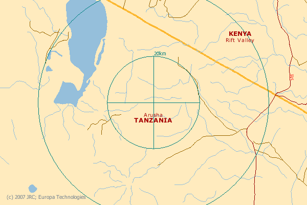
image area: approx.
130x90km2
image area: approx. 65x45km2
| |
|
Legend of symbols in this
page:
|
|
Accuracy of information (move mouse over symbol
to see value) |
Disclaimer
While we try everything to ensure accuracy, this information is
purely indicative and should not be used for any decision making
without alternate sources of information. The JRC is not responsible
for any damage or loss resulting from the use of the information
presented on this website. |

 You are not logged in |
 Contact us:



